“Evangelists and other people over the past 40 years have talked to us about maps, but they’ve always been from the outside - other people’s ideas about our territory. But I walked for two months to make this map. I recognize it. It makes me happy to know that now we have our map. When we are in meetings with the government ministries, and they show us maps of our land, I can take out our map, and show them how it really is. Nihua Quimontasi
In 2015 the Waorani began an ambitious territory mapping project. Their land - and all the animals, plants, trees and other beings that inhabit it - along with the rivers, palm swamps and sacred areas, were at risk from a new oil concession being promoted by the Ecuadorian Government. Much of the Waorani’s million hectare territory has already been irreversibly impacted by oil operations over the last 40 years, but there remain a few areas free from oil. The Waorani saw mapping as a way both of building a community led movement, and illustrating how their lives and culture, interconnected as they are with their forest home, would be impacted by the infrastructure, contamination and social changes that oil exploitation would bring.
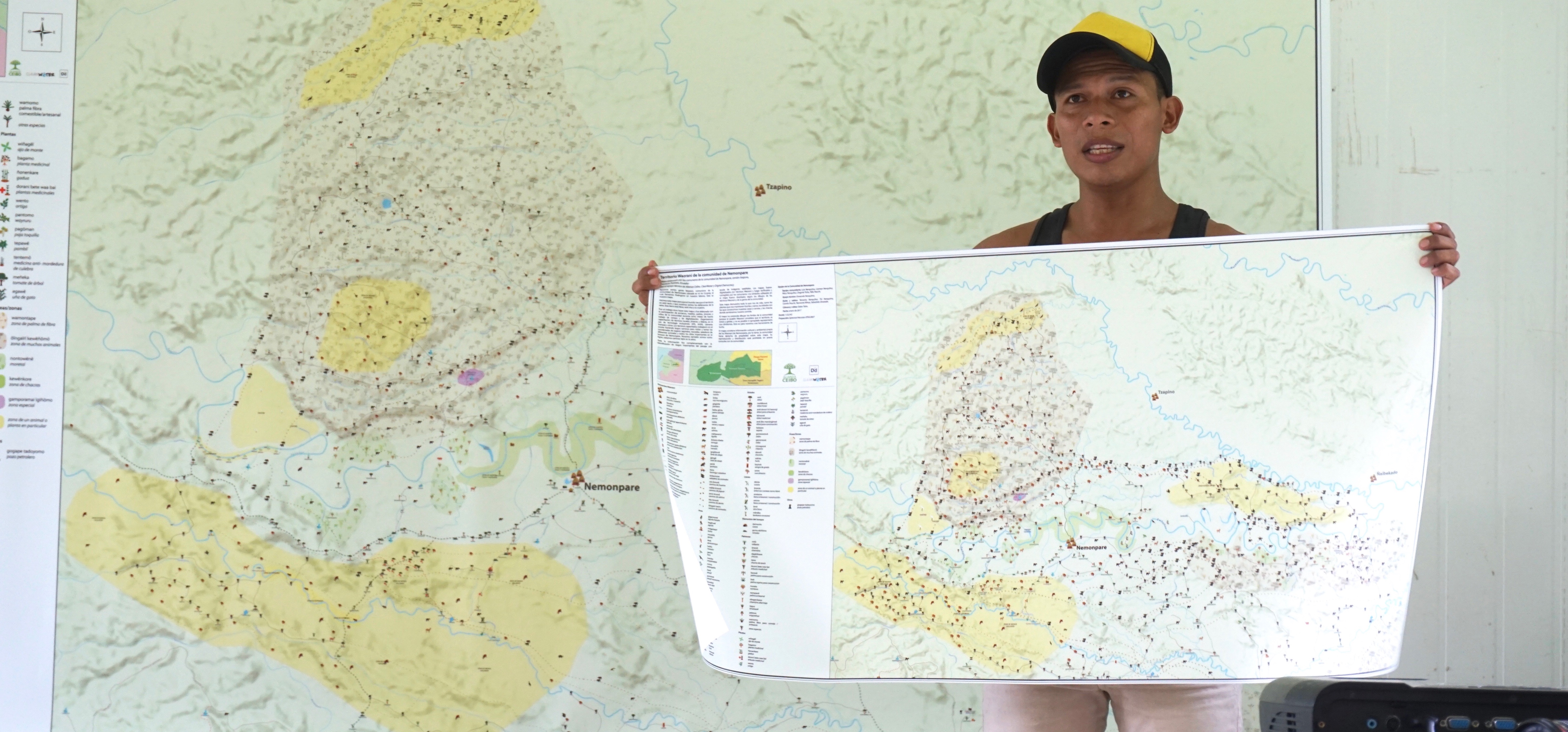
The Waorani draw detailed community maps, take GPS points of important sites, and then add all this information into Mapeo to create the data for printed and interactive maps. Their maps illustrate their deep traditional and ecological knowledge: they are identifying hunting and fishing sites; places they collect fibres for weaving, palms for thatching, natural dyes; areas frequented by different animals and where particular ecosystems predominate; medicinal plants and historical and sacred sites. All the data is collected, edited and managed by the Waorani mapping team.
Community partners:
Dd is partnering with the Waorani territory mapping team of Alianza Ceibo, with additional support from Amazon Frontlines. The Waorani have so far mapped the land of 20 out of 54 communities.
Co-created solutions:
The Waorani territory mapping has been the main pilot project for Mapeo Desktop, and their observations on its interface and features, as well as their identification of, and patience with, its bugs have been critical parts of our design and development process. Our team helped set up Mapeo Desktop with presets and categories named in Waotero (the Waorani language), according to spatial and other categorizations that make sense to them, and using icons which they designed. We are providing ongoing technical and methodological support to the Waorani team.
“With Mapeo we have, for the first time, a tool that we can use to make our own maps, and we can build a strong team of people who can train others to map.” Opi Nenquimo
Impact: The Waorani mapping team has collectively mapped over one million acres of Waorani territory, and produced powerful maps the communities are using for territorial planning and defense. Additionally, the mapping project has helped the team build cohesion and raise awareness of issues relating to territory within and between communities. They are using the maps widely in their campaign against oil concession “Block 22” and Dd helped created an interactive map telling the story of their resistance.
Learn more: